![]() The History
The History ![]()
Of the
Kimball Family
in
Australia
I apologise if I have not
given credits for some of the data & photos here.
![]()
Acknowledgment
A large portion of this history is extracted from
" The History of the Kimball Family in America."
Revised Edition by Judith A. Kimball for the Kimball Family Association.
& " The History of Mercer, Maine
1782 - 1974 "
by Harold Owens Smith
Introduction
![]()
The common ancestor or the great majority of Kimballs in this country and United States of
America
was Richard Kemball1, who, with his family, embarked at Ipswich, in the county of Suffolk,
England, April 10 1634, in the ship Elizabeth,
William Andrews, master. After braving the dangers
of the ocean voyage he arrived in Boston harbour, and from thence went to Watertown, Massachusetts.
He had left the comforts and ties and oppressions of old England to find himself and
children a home in
the New World. It was to him a land of promise, a land of religious and political liberty,
a land to which
the longing eyes of the of the dwellers in old Suffolk were turning as fondly as did the
eyes of the ancient
Hebrews turn in their captivity to the promised land of Canaan. As the Israelites passed
through the "
Wilderness ' and through the deep waters of affliction to reach their haven of rest, so
these sturdy
Puritans, with their families, with undaunted hearts, broke loose from the ties of
friendship, left the
graves of their forefathers, passed over the wilderness of waters and reached the Carann
of their hopes.
An ocean now rolled between them and their early home, and in a new home and savage
country, and
in another hemisphere, they started a new home. They helped to make the beginnings of a
New
England and lay the foundations of a rival to the Old England across the sea. They were of
that Puritan
stock which has in its turn made New England the mother of the great West, the sturdy
stock which
only needs to be convinced that it is right in order to do and dare all that is noblest. A
stock that found a
wilderness people with a few savages, a climate that would have killed a less hardy race,
a soil that is far
from fertile, and yet out of these untoward circumstances wrested success. They came when
the throes
of revolution were agitating the mother country, when the conflict between the adherents
of the
Established Church and the Puritans, between the King and the people, was at its height,
and when the
principals of civil rights and religious liberty were struggling for existence in England
James I., after a feeble reign, had expired March 27, 1625. his son, the ill-starred
Charles I., had
succeeded him. Fires were smouldering in England which would soon burst forth into
devouring flames.
In 1629 Charles I. dissolved the last of three Parliaments, and for the next eleven years
attempted to
rule England by his absolute power. In 1634 the King made his Journey to Scotland, in
order to hold a
Parliament, and by a statute compel the Scottish people to worship by Episcopal rule. A
very difficult
task, which no king, though backed by the power of the church, could accomplish. He made
William
LAUD Archbishop of Canterbury, whose office was an object of aversion to the Puritans.
Under his
authority every corner of the kingdom was subjected to a minute inspection, and every
little band of
Separatists or Puritans, as their adversaries called them, were tracked out and broken up,
even the
religious ceremonies of private families did not escape the vigilance of his spies. Deadly
hatred of the
Established Church and of the king as its head was thus engendered in thousands of homes.
These acts rendered England so uncomfortable that the Puritans were compelled to seek a
home
elsewhere. They, therefore, sought a dwelling place in the wilderness of the new world,
and they called
their home, in loving remembrance of the old home from which they came, New England. Here
they
sought to worship God unmolested by bishops. There was but little opposition to the first
migration, but
three years later, in 1637, by an order of the king and council, eight vessels laying in
the Thames and
ready to sail, freighted with Puritans, were detained. In these vessels were embarked Sir
Arthur
HAZELRIG, John HAMPDEN, John PYM, and Oliver CROMWELL, the Great Protector, who
afterwards signed the death warrant of King Charles, in 1649. Such was the condition of
affairs in
England, and such the insults, persecutions, and wrongs heaped upon the Puritans in 1634,
which the
proud spirits of many could not brook, but in the wilds of New England they sought out a
home in
which they might be free.
The leaders of the exodus were many of them men of influence in England, and they brought
with
them many men of the middle classes, who were also tired of tyranny and exaction's to
which they were
subjected. To this class belonged the sturdy wheelwright, Richard KIMBALL1. He had a trade
which
would be eminently useful in the new colony. his services were in such request that he was
soon called
to leave his first settlement at Watertown and go to Ipswich, where he was given a house
lot, and other
privileges, on condition that he should be the town Wheelwright.
 The Early History
Rattlesden & Hitcham, Suffolk County, England
birth place of Richard Kemball
Rattlesden is situated in Suffolk County,
65 miles north east of London, approximately
halfway between Bury Saint-Edmunds and Ipswich. The Suffolk area was one of the
first landing sites of the Romans when they entered Briton and defeated the
Celtic-speaking Britons in AD 43. Many tribes, especially those with strong trading
contacts, welcomed the Romans, or at least submitted without a fight. These included
many enemies of the overking Cunobelinus. Others fought and were defeated. The
Iceni of Norfolk were among those who submitted quietly, and the Romans were able
to celebrate their triumph within a matter of months while their armies fanned out
northwards and westwards.
The first Viking raids, in the 790s, were merely for
plunder, but the later Danish
armies of the ninth century were out for a more lasting gain.
In the middle years of the ninth century England was still divided among the four
great independent Anglo-Saxon kingdoms Mercia, Northumbria, East Anglia and
Wessex.
By 878 only Wessex remained, the others ruthlessly conquered by the Danes. The
Viking descent on England then was a blitzkrieg of a permanent kind. After it there
would be no return to the old ways, only change and accommodation.
With their traditional ways of raising armies and methods of fighting, the old kingdoms
found it impossible to resist the Vikings with their longships and their fast moving
armies. When in 867 the ancient kingdom of Northumbria ended in flames as York
burned down, their king Aelle suffered the " blood eagle ", a Viking rite in
which the
victim was offered to Odin and his ribs and lungs were cut from the living man and
spread like eagle's wings behind him. The Danes then set up a puppet king ( Edmund )
in Northumbria north of the Tyne, a man who would pay them tribute and cause them
no trouble.
In 869 the blood eagle was performed on Edmund, king of the East Angles, the last
successor of the Wuffingas of Sutton Hoo.. Edmund was first buried near his royal
residence, at Sutton, before he was moved to his final resting place at Bury
Saint-Edmunds in the 930s.
In 874 Burgred, king of Mercia, Heir to Offa and the great Mercian kings, abdicated
and fled to Rome. Soon after these events, large-scale , permanent Danish
settlements began to appear in Northumbria, East Anglia, and in southern Mercia. To
educated men in Wessex it must have seemed that the very survival of Anglo-Saxon
civilisation was now in the balance.
After an initially successful peace agreement with the Danes soon after his crowning
as King of Wessex, Alfred (known as Alfred the Great to historians) found himself at
war with them in around 878. A supreme and brilliant soldier, Alfred defeated the
Danes and by 886 had captured London as was recognised as king of England.
The Danes attacked Alfred's kingdom from their territories in the Danelaw
(consolidated land existing of what had been East Anglia, Northumbria and some of
Mercia) again in 893 but were defeated again after four years of battle with the
awesome warrior. After Alfred's death in 899 his son Edward defeated the Danish
settlers in Essex and East Anglia, and by 944 when his grandson Edmund drove them
from Northumbria, the Danish occupation of England had ceased forever.
After Edmund's victory over the resident Danes, England suffered numerous attacks
from various Danish kings launching sorties from Denmark and annexing England for
tribute, but it was not settled or occupied for any significant amount of time during
this period. Eventually, court disputes in England lead to Richard of Normandy
invading and resoundly defeating the English, lead by King Harold, in 1066 and
claiming the English crown for William I, the Conqueror.
Subsequent to his victory William I set about taking inventory of the entire country, (
1066 - 1086 ) town by town, village by village, down to the smallest huts. Everything
was counted even the stock and farm tools. This huge inventory was to be known as
the ' Domesday Book ' and is still intact today and used as a major source of early
English history . It is from these records we learn that Suffolk County was at this time
made up of predominantly villages and freemen, rather than of manors and feudal
vassals. Its population was fairly evenly distributed. Only in the north-west, where
sandy, barren brekland gave way to the fens, were there large uninhabited areas.
Forest covered much of the central and north-eastern uplands; the sandy eastern
shore was crumbling then as it is now. None of the seven principal towns, which
included Ipswich, Bury St Edmunds and Dunwich, had more that 3000 inhabitants.
One of the curious pleasures of Domesday is its meticulous census of livestock. In
Suffolk it records 4343 goats, but only two lonely donkeys.
Rattlesden during this time was known as Rasted, Rathsted, Ratlesdena and
Ratesdana, the tenants-in-cheif were Heltret from Count Eustace; Count of Mortain;
Abbot of Ely and William de Warenne and Count of Mortain from him; Richard
FitzGilbert; William de Warenne and Humphrey son of Roderic from him. It had one
church and paid a tax of forty pigs.
Following the ' Black Death ' plague in 1348 there was a severe shortage of men and
labour, so the barons were forced to let their fields turn to grass. To earn an income
they ran sheep on the grassy fields and sold the wool to the Flanders ( Belgium ) .
Wool became very valuable and many weavers moved to England to live, and towns in
Norfolk, Suffolk and Gloucestershire became very rich.
Early church records of wills show that the Kymboldes were quite significant land
holders in the 1400 & 1500s with Henry ( will proved March 14, 1523-4 ) leaving his
children such properties as; " I wyll that Richard Kymbolde my sonne shall have my
house that I dwell in called Brakys, also my tenement called Warrens . Henry
Kymbolde to have my tenement called Pokellys with a croft, called Halles Croft, and
another croft called Swymer field.
The Kemballs lived chiefly in the southwest of Suffolk county, and the old parish
registers and the churchyards of the parishes of Rattlesden, Groton, Boxford,
Bildeston, and Felsham are full of the names of Kemballs
Taking all these facts into
consideration it would be a safe assumption that the
Kimballs are most likely descendants of the Danes, Angels and Normans.
Geography
The Counties of Suffolk East & Suffolk West are situated in south east England, 65
miles northeast of London with Ipswich in the east and Bury St. Edmunds in the west
the largest cities. The countryside is mainly flat, falling away into marshes on the
northwest and northeast borders. The tributaries of the Waveney and of the Stour,
Lark, and Gipping are the chief rivers. The principal industry is agriculture, and the
counties are two of England's chief grain-raising areas. Other crops include sugar
beets and fruits. Livestock raising and fishing are also important
Rattlesden, the birthplace of Richard Kemball is a few short miles west from
Stowmarket and the site of St. Nicholas Church
where Richard was baptised c.1595.
The church records hold evidence that the Kimballs ( Kemball, Kembold, Kembolde,
Kymbolde ) had lived in the Suffolk area for several hundred years.
It is safe to say that the names of Kemball and Kemble have been distinct names for
at least six hundred years and that there is no evidence that they were ever the
same. The Kemballs have always belonged to the so-called middle class in England. On
the other hand, the Kembles have lived in Wiltshire even longer. They have a coat of
arms and belong to the nobility. Only one family of the Kembles was early in New
England, and their descendants have ceased to exist, in the male line.
Hitcham is another village where generations of Kemballs were born and baptised, ( a
large " charities " plaque mentions a Thomas Kemball ) and is to the south of
Rattlesden. Buxhall also houses a plaque signed by a Churchwarden William Kemball
as late as 1840. There does not appear to be any remaining Kemballs in the Suffolk
area today.
Source; History of the Kimball Family in America, Doomsday Book, and various others
![]()
Home
in
The
NEW WORLD
![]()
Watertown, Massachusetts USA ![]()
first home of Richard Kimball
the Emigrant.
Watertown is situated in Middlesex County, 7 miles west of Boston. It was settled and
incorporated in 1630.
Richard first settled in Watertown, and his home lot is thus given by Dr. Henry Bond
" Richard Kimball, six acres,
bounded on the north by Cambridge, east by the land of W. Hamlet, south by the highway,
and west by land of
Edward White. "
The lot was situated near what is now the corner of Huron avenue and Appleton street, and
near springs of water.
He was proclaimed a freeman on 6 May 1635 and was a proprietor in 1636-7.
Soon after this date he was invited to remove to Ipswich, where they were in need of a
competent man to act as
wheelwright to the settlement.
A Typical framed house of the 1600s.
![]() Ipswich, Massachusetts USA
Ipswich, Massachusetts USA ![]()
death place of Richard Kimball
Richard spent the remainder of his days in Ipswich. The town granted him a house lot 23
Feb 1637. He was also
granted at the same time " 40 acres Beyond the North Riuer near the land of Robert
Scott." In 1639 he had the
liberty to pasture " two cows free. " On " the last day of the last month
1641" he is mentioned as " Among the
Commoners of Ipswich. " He was appointed one of the seven men on 1 Mar 1645. On the
" 22nd day of the tenth
mo. 1647 " he was allowed two Pounds for killing two foxes. His services as
wheelwright were appreciated by his
townspeople, for he was permitted in January 1649, " to fell such white Oaks as he
hath occasion to use about his
trade for the town use. " In 1660 he was granted the right " to fell 20 white
oak trees to make weels for the
townsmen their use. " In 1664 he owned 43 shares in " Plumb Island."
Ipswich, one of the oldest towns in the United States, founded in 1633, is centrally
located on the North Shore of
Massachusetts, approximately 28 miles north of Boston. The town is 33 square miles and has
a landscape that includes
marshes, dunes and beaches, uplands,
forests, fields, and farmland. Ipswich is well known for its early 17th century homes with
more than forty houses built prior to
1725 still standing and occupied. It has a very distinct in-town residential and business
district and several industrial sections.
The town encompasses seven hills, and through its heart runs the Ipswich River. The river
has its source some 45 miles to the
west and flows fresh through the center of town, where it becomes tidal and salt, as it
completes its journey to the Atlantic
Ocean. The town contains a variety of industries and businesses. Ipswich is also well
known for its shellfish, the famous
"Ipswich Clams", and nearby are several shellfish processing plants. In addition
to its well rounded business community, the
town has several large farms that sell their produce locally, and a family-run orchard
that caters to "picking-your-own" style
outings. Ipswich is one of the few communities in Massachusetts with its own diesel
operated lighting plant which helps to
reduce our power rates. A town with a rich and diversified community life, cultural and
civic organizations, fifteen churches
and three seminaries. Every town thinks itself unique and special, but Ipswich truly is,
because of its people, its place in
history, its institutions, its location and landscape.
Birthplace of American Independence, First lace making Town in America, Birthplace of
American Hosiery, Home of the
original and famous Ipswich Clam, Historic Homes and Crane Beach.
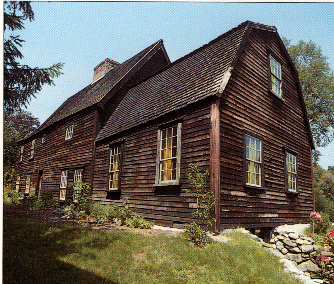
The Whipple House,
owned by the Ipswich Historical Society, is an outstanding example of 17th Century
architecture. Here visitors are given the
opportunity to study in leisurely fashion the enormous fireplaces, original pine paneling,
beautifully chamfered chestnut beams,
gunstock posts, pegged construction and overhang.
Furnishings are of the 17th and 18th centuries. The Historical Society has been building
this collection since 1890. Here, also.
one may see a charming 17th century garden with more than 60 different plants, maintained
with the help of the Garden Club.
The Whipple House is one of the oldest buildings standing in New England. Was half built
1638-40. East half built in 1670.
This house was in the Whipple family for two hundred years.
![]() History of Ipswich, Essex, and Hamilton
History of Ipswich, Essex, and Hamilton ![]()
by
Joseph B. Felt
Introduction
The name given to Ipswich by Indians, was Agawam, sometimes spelt differently.* With this
name, no doubt, many
successive generations of the natives associated thoughts of childhood and of riper age,
of sports and toils, of ease and
adventures, of safety and perils, of peace and war, of joys and sorrows. It was a word
applied by the Aborigines to
several portions of Massachusetts. It seems to have denoted places, where fish of passage
resorted. Captain Smith
informs us, that after he had
made out a draught of this country in 1614, with the names which had been given to its
different divisions, Prince
Charles had Agawam exchanged for Southhampton. This name is on the Captain's map, prefixed
to his account of
New England.
181634, Aug. 4th. Agawam is called Ipswich, being a town in England, by the Court of
Assistants, "in
acknowledgment of the great honor and kindness done to our people, who took shipping
there."
Thus altered from an appellation, long familiar to the ears, and long dear to the hearts
of the Agawames, it received
another more familiar and dearer to Englishmen.
SITUATION AND EXTENT
Before Europeans came to this country, Agawam reached from Merrimack River on the north,
to Naumkeag River,
now of Salem, on the south; from Cochichawick, afterwards named Andover, on the west, and
to the sea-side on the
east. When it was settled by Mr. Winthrop and others, its boundaries on the north and west
remained the same; but
those on the east, were its own bay and that of Squam, and the town of Gloucester; and on
the south were
Manchester, Wenham, and Danvers, all four of which latter places were then villages
belonging to Salem. Johnson
remarks on
this territory, "The Sagamoreship or Earldom of Agawam, now by our English nation
called Essex."
181636. Wessacumcon, or Newbury, being settled, the court order, that Ipswich shall run
six miles into the country.
As population flowed in and spread over its surface, as corresponding necessities arose
and reasons for separation
successively prevailed, this town became reduced to its present size.
The latitude of Ipswich, as taken at the Court-house, is 42� 41' north, and longitude, at
the same place, 70� 50' west.
This place, now having Rowley on the north, Boxford and Topsfield on the west, Hamilton
and Essex on the south,
and the ocean on the east, has an area of 25,478 acres. Of this 3,579 acres are water,
1,509 sand on Castle Neck
and Plumb Island. There are 72 miles of roads.
Before we fully attend to the various concerns of the English, it may not be out of place
to give a parting notice to
the Indians, who owned and occupied the land, on which their more intelligent and powerful
successors entered.
INDIAN INHABITANTS
When we look back on the Aborigines, as the sole proprietors of our soil, on the places
which once knew them, but
are now to know them no more for ever, feelings of sympathy and sadness come over our
souls. Such reflection,
though not presenting us with monuments of the civilized arts, nor with the productions of
literature, nor with the
improvements of science, to secure lasting fame, still sets before us, in the light of
history, a tribe of men immortal as
ourselves, who have irrevocably disappeared from the scenes and concerns of earth.
1611. Capt. Edward Hardie and Nicholas Hobson sailed for North Virginia. They touch at
Agawam, where the
natives treat them more kindly than others had done. 33These people must have been far
more numerous at this
visit, than they were subsequently, because a plague swept off most of the New England
Indians about 1617.
1629. They inform Governor Endicott, that they are fearful of an invasion from the
Tarrentines or Eastern Indians.
He immediately despatches a boat with Hugh Brown and others, to defend them. Such aid was
afforded them
several times. 22June 13th. "Lord's day, in the morning, the Sagamore of Agawam and
one of his men came on
board our ship and stayed with us all day." This chief was called Masconnomo, but
more commonly Masconnomet,
and sometimes John. 2It is evident from the account given by Masconnomet's grand-children,
when they received of
different towns compensation for land, which he had owned, that his jurisdiction was as
extensive, as already
described. About 1630, he was at Saugus, and with other Indians witnessed the sale of
Nahant and other land by
black William, to William Witter for two pestle-stones.
1631, July 5th. "The Sagamore of Agawam is banished from every Englishman's house for
the space of one year, on
the penalty of ten beaver skins." 22Aug. 8th. "The Tarrentines, to the number of
100, came in three canoes, and in
the night assaulted the wigwam of the Sagamore of Agawam, slew seven men, and wounded John
Sagamore, and
James, and some others, (whereof some died after,) and rifled a wigwam of Mr. Craddock's
men, kept to catch
sturgeon, took away their nets and biscuit." 34The wife of James and others were
carried away captives by their
enemies. According to report, Masconnomet had slain some, belonging to the people of these
invaders. John and
James, previously mentioned, were sachems, the former of a tribe on the west of Saugus,
and the latter of a tribe in
that town. It is very likely, that they had come, as allies, to Masconnomet, because he
often dreaded an attack from
his eastern foes. 22Sept. 17th. Abraham Shurd of Pemaquid, sends to
Agawam James's wife, who had been recently captured. He writes that wampum and
beaver-skins are demanded for
her ransom.
1638, March 13th. Masconnomet sells his fee in the soil of Ipswich to John Winthrop, Jr.,
in behalf of its
inhabitants, for �20.
1639. In the southwest part of Ipswich, now appertaining to Middletown, there was an
Indian plantation. This
contained a hill, called, 1661, Will Hill, from old William, an Indian, who, 1660, seems
to have owned considerable
land.
18 March 5th. Masconnomet is to have his gun mended, which the Governor's servant broke.
He is also allowed
powder to kill fowl and deer. He acknowledges himself satisfied with what Mr. Winthrop
paid him for his right to the
territory of this town.
1642, Sept. The Agawames and other tribes are to have their arms restored, having been
taken from them because
it was suspected that they intended to rise against the English.
1644, March 8th. Besides four other Sagamores, Masconnomet puts himself, his subjects, and
possessions under the
protection and government of Massachusetts, and agrees to be instructed in the Christian
religion. The following
questions are submitted to these chiefs, who give the accompanying replies.
1st. Will you worship the only true God, who made heaven and earth, and not blaspheme?
Ans.
"We do desire to reverence the God of the English and to speak well of Him, because
we see He doth better to the
English, than other gods do to others."
2d. Will you cease from swearing falsely?
Ans. "We know not what swearing is."
3d. Will you refrain from working on the Sabbath, especially within the bounds of
Christian towns? Ans. "It is easy
to us, --- we have not much to do any day, and we can well rest on that day."
4th. Will you honor your parents and all your superiors? Ans. "It is our
custom to do so, --- for inferiors to honor superiors."
5th. Will you refrain from killing any man
without just cause and just authority? Ans. "This is good, and we desire so to
do." 6th. Will you deny
yourselves fornication, adultery, incest, rape, sodomy, buggery, or bestiality? Ans.
"Though some of
our people do these things occasionally, yet we count them naught and do not allow
them."
7th. Will you deny yourselves stealing? Ans. "We say the same to this as to the 6th
question."
8th. Will you allow your children to learn to read the word of God, so that they may know
God aright and worship
him in his own way? Ans. "We will allow this as opportunity will permit, and, as the
English live among us, we desire
so to do."
9th. Will you refrain from idleness? Ans. "We will."
After Masconnomet and the other chiefs had thus answered, they present the Court with
twenty-six fathoms of
wampum. The Court, in return, order them five coats, two yards each, of red cloth, and a
pot full of wine.
1652, April 17th. Peckanaminet, alias Ned, an Indian, and sometimes called Acocket, of
Ipswich, had recently
mortgaged for �30 his land, about eight miles square, on the further side of Merrimack,
lying eight or ten miles from
Andover. This Indian was aged 68 in 1676. He had a brother, Humphrey. Both of them, like
most of their red
brethren, possesing land and surrounded by whites and tempted by rum, were continually
distressed through their
improvident debts.
1655, Feb. 21st. "Left to the seven men to grant to the Sagamore six acres of
planting land, where they shall
appoint, for to plant, but not propriety to but himself.
1658, June 18th. "Granted the Sagamore's widow to enjoy that parcel of land, which
her husband had fenced in,
during the time of her widowhood." Thus we have notice of Masconnomet's decease. He
had lived to behold his
people almost extinct, and to perceive his power dwindled to the very emblem of weakness.
As the last of the Chiefs,
who ruled over the Agawames, his feeble and broken sceptre descended with him to the
grave. He was buried on
Sagamore Hill, now within the bounds of
Hamilton. His gun and other valued implements were interred with his body. 18March 6th.
Idle curiosity, wanton,
sacrilegious sport, prompted an individual to dig up the remains of this chief and
carry his skull on a pole through Ipswich streets. Such an act of barbarity was severely
frowned on, and speedily
visited with the retributions of civil justice.
1671, Feb. 21st. "Granted Ned two or three acres to plant, during his life, in some
convenient place, if he fence it
sufficiently with stone wall.
1678, Dec. 23d. Several Indians, living in a wigwam, are furnished with some provisions by
the town.
1683, Feb. 27th. Surveyors are empowered to lay out a small quantity of land for Ned and
his family and the old
Sagamore's daughter and her children, to improve for them, during the town's pleasure.
1686. John Dunton was accompanied from Wenham to Ipswich by an Indian, who gives him the
common
salutation of his tribe, ---netop, friend. Mr. Dunton describes a funeral, which took
place near Ipswich, and which
shows the custom of the Agawames, in so solemn a service. When the mourners came to the
grave, they laid the
body near by, then sat down and lamented. He observed successive tears on the cheeks of
old and young. After the
body was laid in the grave, they made a second lamentation; then spread the mat, on which
the deceased had died,
over the grave; put the dish there, in which he had eaten, and hung a coat of skin on an
adjacent tree. This coat
none touched, but allowed it to consume with the dead. The relatives of the person, thus
buried, had their faces
blacked, as a sign of mourning.
1690, Feb 18th. Ned is still assisted by the town and is aged about 82. --- Dec. 30th.
Robert, an Indian, is similarly
helped.
1726. There were three families, each having a wigwam back of Wigwam Hill at the Hamlet.
It is probable, that,
not long after this year, Indians disappeared from among the inhabitants of Ipswich. Had
letters flourished among
the Agawames, many of their transactions, fitted to excite pity and admiration, to draw
forth censure and approval,
would have been recorded on the pages of history. But such a privilege, with which a kind
Providence has favored us,
was not theirs. Hence no register
exists to tell us where the red men, who once held undisputed sway over our soil, had
their homes and corn-fields,
their places of fishing and hunting, of feasting and amusement, their battle grounds, and
their consecrated spots for
council and for worship.
REMAINS OF THE AGAWAMES
SHELLS. In many places, and particularly on high land, abundance of clam shells have been
ploughed up. These
shells were undoubtedly carried thither with their contents, as food, by the natives.
TOMAHAWKS. These are stones of various species, averaging the length of a common-sized
man's hand, with a
place towards one end, where handles were fastened, and with the other end brought down to
an edge. They
continue to be frequently discovered in different spots. They were used by Indians before
they obtained iron from
Europeans, whom they called Chauquaquock, or "knife-men." Though rude, such
weapons must have proved deadly
to opposing foes.
GOUGES. These, of hard stones, are about half a foot long, and have one end sharpened. The
process of
manufacturing articles with them would be most tedious to the mechanic of our day, who is
favored with the great
improvements of art.
PESTLES AND MORTARS. These, composed of granite, have been occasionally disinterred. They
were for such
purposes as the pounding of dried berries and corn. There are relics, whose use is not
certain. Some of them are
stones nearly round and encircled with a groove for strings or withes. They were probably
used in battle. Others are
formed much like a small pear, with the slender end fitted for a string. They may have
been worn as ear-drops by the
natives, who were strangers to the factitious charms of gold and diamonds.
HEADS OF ARROWS. These are met with in great numbers. They are of a flinty substance and
of several colors
and sizes. They have been generally discovered on swells of land facing each other. This
is an indication that some
great battles were fought there. When such events were, who the parties engaged, what the
cause of their conflict,
the greatness of the slaughter, the number of captives, the results of the combat, are
particulars once known to the
tribes concerned, once related by fathers to their listening children; but now beyond the
reach of our perception,
though fresh in the remembrance of Him, "who will bring to light the hidden things of
darkness."
DEED
"I Masconnomet, Sagamore of Agawam, do by these presents acknowledge to have received
of Mr. John Winthrop
the sum of �20, in full satisfaction of all the right, property, and claim I have, or
ought to have, unto all the land,
lying and being in the Bay of Agawam, alias Ipswich, being so called now by the English,
as well as such land, as I
formerly reserved unto my own use at Chebacco, as also all other land, belonging to me in
these parts, Mr.
Dummer's farm excepted only; and I hereby
relinquish all the right and interest I have unto all the havens, rivers, creeks, islands,
huntings, and fishings, with all
the woods, swamps, timber, and whatever else is, or may be, in or upon the said
ground to me belonging and I do hereby acknowledge to have received full satisfaction from
the said John Winthrop
for all former agreements, touching the premises and parts of them; and I do hereby bind
myself to make good the
aforesaid bargain and sale unto the said John Winthrop, his heirs and assigns for ever,
and to secure him against the
title and claim of all other Indians and natives whatsoever. Witness my hand.
28th of June, 1638
Witness hereunto,
John Joyliffe,
James Downing,
Thomas Coytimore,
Robert Harding,
Masconnomet
" his mark."
1639, Nov. 5th. Ipswich is required to pay John Winthrop, Jr. the �20 which he paid the
Sagamore for his right to their land.
1705, Feb. 22d. "Voted, that Samuel Appleton, Esq., and our two Representatives treat
with the Hon. Wait Winthrop, about Masconnomo's deed of Agawam, made to his father
deceased, Governor of Connecticut.
PLACE FIRST OCCUPIED AS THE TOWN
From the phraseology, used when grants of land were first made to people of Ipswich, it is
evident that the Town, so
denominated by way of distinction, was located on the Neck. This was immediately bounded
on the east by what is
now known as Jeffrey's Neck. It appears, that originally the whole neck, the western part
of which was selected for
the town, was called after the same person. It seems that William Jeffrey had given name
to this neck, and also to
the creek, afterwards Manchester, before Agawam was settled in 1633. To this point the
following is adduced.
161628. Jeffrey and Burslem are assessed �2 towards the expenses of the expedition
against Morton at Merry
Mount. There can be but little doubt, that Jeffrey was, this year, a resident in the
original bounds of Agawam,
because no writer or document has shown, that he lived elsewhere, and two places within
such territory very early
received their names from his.
171634. Winthrop, speaking of Jeffrey's handing him a letter from Morton, calls him,
"an old planter."
18 1666. William Jeffrey claims the Neck, of his name, in the limits of Ipswich. He is
granted five hundred acres of
land on the south side "of our patent, to be a final issue of all claims by virtue of
any grant, heretofore made by any
Indians whatsoever."
FIRST SETTLERS
For a considerable period from the permanent occupation of Agawam, no persons were
considered as its
inhabitants, without the consent of its freemen. This was a regulation throughout the
colony, which preserved each
community from the intrusion of the idle, contentious, and immoral. Were such a regulation
now acted on by all our
towns, not merely to guard against anticipated expenses of pauperism, but also to keep off
the contagion of vice, so
many of them would not be under one of the worst of tyrannies, even amid the praises of
their freedom, a tyranny of
being ruled
by the votes of the unprincipled, who are ever ready to hinder the best good of society
and to bring down upon it the
curse of their iniquities.
22*1633, March. John Winthrop, Jr. and twelve others commence a settlement here. 17April
1st. The Court of
Assistants forbid any to reside in this place, without their leave, except those already
come. Then follows a list of
them; viz. --- Mr. John Winthrop, Jr., Mr. William Clerk, Robert Coles, Thomas Howlet,
John Biggs, John Gage,
Thomas Hardy, William Perkins, Mr. John Thorndike, and William Serjeant. Three are wanting
to make up the
first number. June 11th. Thomas Sellan has
permission to become an inhabitant.
* The late excellent map of Ipswich mistakes in making its settlement in 1632.
221634, May. Before the people of Newton emigrated to Connecticut, "they sent men to
Agawam and Merrimack,
and gave out they would move." 34Rev. Thomas Parker and company out of Wiltshire,
being about one hundred,
and other new settlers, take up their abode here.
Besides the preceding individuals, are those on the following list, having the years, up
to 1652, when they are first
met with, as belonging to Ipswich. The spelling of their names is put down as they were
found written.
1635 1637 1639 1642 1643 1648 Andrews Robert, Appleton Samuel, Avery Wm., Archer Henry,
Andrews John,
Annable John, Adams Wm., Andrews Richard, Averil Wm., Appleton John, Ayres John,
Bracey Thomas Mr.,
Bradstreet Dudley, Bradstreet Humphrey, Bradstreet Simon Mr., Bartholomew Wm., Bishop
Thomas, Bishop Nathaniel, Bixbey Nath'l., Browning Tho's., Boreman Tho's., Brown Edward,
Burnam John, Baker John, Button Matthias, Bird Thos., Belcher Jeremy, Bellingham Rich'd.
Mr., Bosworth Nath'l., Bird Jathnell, Boreman Sam'l.,
Bachellor Mr., Brown John, Beacham Robert, Bitgood Rich'd., Bachellor Henry, Brewer
Tho's., Buckley Wm.,
Bridges Edmund, Burnam Thomas, Bosworth Haniel, Bragg Edward, Betts Richard, Birdley
Gyles, Bishop Job,
Bixbey Joseph, Carr George, Curin Mathias, Cross John, Cogswell John Mr., Covengton John,
Clark Daniel, Clark Thomas, Cross Robert, Challis Phillip, Colebeye Arthur, Comesone
Symond, Cooley John, Cartwright Michael,
Cachame Henry, Crane Robert, Comings Isaac, Cachame Edward, Chute Lionel, Castell Robert,
Cowley John,
Chelson Robert, Chapman Edward, Chute James, Catchame John, Clark Malachi, Choate John,
Cogswell Wm.,
Colborne Robert, Dillingham John, Dudley Thomas Mr., Dudley Samuel Mr., Dennison
Daniel Mr., Dorman Thomas, Dix Widow, Dane John, Davis John, Dane John Jr., Duglas Wm.,
Davis Richard, Dane Francis, Day Robert, Dennison John, Dutch Robert, Dix Ralph,
Elliot ---, Easton Nicholas Mr., Emerson Thomas, English Wm.,
Eppes Dan'l. Mr., Emerson Joseph, Emerson John, Franklin Wm., Fuller John, Fawne John Mr.,
Fuller Wm., Fowler Philip, Foster Wm., Firman Tho's. Mr., French Tho's. Mr., French
Edward, French Tho's. Jr., Filbrick Robert, Firman Giles Doct., Farnum Ralph, Fellows Wm.,
Foster Abraham, French John, Goodhue Wm., Gardner Edmund, Giddinge George, Graves
Robert, Gibson Thomas, Greenfield Samuel, Gilven Thomas, Green Henry, Gutterson Wm.,
Granger Lancelot, Gilbert Humphrey, Greene Thomas, Gillman Edward, Griffen Humphrey,
Hubbard Wm. Mr., Hassell John, Haffield Rich'd., Hall Samuel, Hart Nathaniel, Harris
Thomas, Heldred Wm., Hayes Robert, Hovey Daniel, Hauchet John, Humphrey ___,
Huttley Richard, Hadley George, Hodges Andrew,
Hart Thomas, Hoyt John, Howe James, Hunter Robert, Heard Luke, Heiphar Wm., Harris
Anthony, Harris Thomas, Harindin Edward, and before. Jeffrey Wm., Jackson John, Johnson
John, Jordan Francis, Jacob Richard,
Jennings Richard, Jordan Stephen, Knight Alexander, Kent Richard, Kinsman Roberrt, Kemball Richard, Kingsbury Henry, Knight Wm. Mr., Kemball Henry, Knowlton John, Knowlton Wm., Knowlton Tho's., Knight Aleph, Kemball Rich'd. Jr., Lancton Roger, Lord Roberrt, Lamson Wm., Ladd
Daniel, Lord Katherine widow,
Lumkin Richard, Lee John, Lee Tho's., Lumas Edward, Lumas Richard, Low Tho's., Lovell
Tho's., Long Sam'l.,
Lancton Joseph, Long Phillip, Layton John, Leigh Joseph, Manning John, Moody Wm.,
Metcalf Joseph, Mussey John, Mussey Robert, Merriall John, Mosse Joseph, Morse John,
Medcalf Tho's., Miller Wm., Mohey Robert, Newman John, Norton John Mr., Norton Wm. Mr.,
Northe John, Newmarch John, Nichols Richard, Newman Tho's., Osgood Christopher,
Perkins John, Perkins John Jr., Parker Thomas Mr., Procter John, Perley Allen,
Pebody Francis, Pike --- Mr., Purrier Wm., Perkins Isaac, Paine Wm., Pitney James, Preston
Roger, Paine Robert,
Perry Thomas, Pettis John, Pingrey Moses, Pinder Henry, Podd Daniel, Perkins Jacob,
Pinder John, Pingrey Aaron,
Podd Samuel, Pearpoynt Robert, Pendleton Bryan Mr., Prichard Wm., Palmer George, Potter
Anthony, Quilter Mark, Robinson John, Rogers Nath'l. Mr., Reading Joseph, Rawlinsone
Tho's., Robinson John, Reddin John, Roberts Robert, Ringe Daniel, Rawlinsone Tho's. Jr.,
Roffe Ezra, Roffe Daniel, Shatswell John, Symonds Mark,
Spencer John, Sewall Henry Mr., Saltonstall Rich'd. Mr., Short Anthony, Short Henry,
Symonds Wm., Sayward Edmund, Saunders John, Sherrat Hugh, Scott Thomas, Sherman Samuel,
Seaverns John, Sawyer Edmund, Symonds Samuel Mr., Silver Thomas, Sherman Tho's., Scott
Robert, Stacy Simon, Swinder Wm., Smith Tho's.,
Story Andrew, Safford Tho's., Scofield Rich'd., Setchell Theophilus, Smith Richard,
Silsbee Henry, Smith George,
Story Wm., Stacy Tho's., Stone Nath'l., Scott Tho's. Jr., Satchwell Richard, Smith Robert,
Salter Theophilus,
Tuttle John, Treadwell --- Mr., Treadwell Edward, Turner --- Cap., Thornton John,
Treadwell John, Treadwell Tho's., Taylor Sam'l., Thomson Simon, Tingley Palmer,
Varnum George, Vincent Humphrey Mr., Ward Nath'l. Mr., Williamson Paul, Wyatte John,
Wainwright Francis, Wells Thomas, Webster John, White Wm., Whityear John,
Wade Jona. Mr., Woodmansee --- Mr., Wythe Humphrey Mr., Wilson Theophilus Mr., Wedgwood
John, Whitred Wm., Williamson Michael, Warren Wm., Wattles Richard, Whittingham John Mr.,
Whipple Matthew, Whipple John Mr., Wilkinson Henry, Whitman Robert, Wallis Robert, Warner
Daniel, Windall Tho's., Wood Daniel Cap.,
Whittingham Tho's. Mr., Woodman John, Warren Abraham, Walderne Abraham, Ward John Doct.,
Whipple John Jr., Whitred Thomas, Walderne Edward, West John, Wooddam John, Warner John,
Wood Obadiah, Walker Henry, Younglove Samuel .
GRANTS OF LAND
181629, May 21st. The Assistants of the Company, who settled Massachusetts, meet in London
and order that two
hundred acres be allowed to each adventurer for �50 in the common stock, and so after
this rate. They agree that
such adventurers shall have fifty acres for each person whom they send over. They appoint
that every man, who has
no share in the general stock, and who transports himself and family at his own expense,
shall have at least fifty
acres. These were the rules, observed by all the ancient towns, in dividing their
territory among their population. No
individual was permitted for many years, to have any concern in assigning lots, unless he
was a freeman. When
business of this kind was to be transacted, the meeting for it was headed, Grants made
"by the company of freemen."
Owners of farms had house-lots in the town. This accorded with the following regulation.
181635, May. "No dwelling-house shall be built above a half-mile from the
meeting-house in any new plantation,
without leave from the Court, except mills and farm-houses of such as have their dwellings
in town." It was intended
to give here a particular account of each grant, but our want of room forbids. The highest
number of acres,
assigned, at one time, to any person, was somewhat above three hundred. The freemen voted
very few lots of land to
persons, who came to reside among them, after 1650. The soil, being variously apportioned
out up to this period, has
passed from
one hand to another, so that a large division of it is held by those of a name, different
from that of its original
proprietors. Such a transfer has been especially promoted, since the right of entailment
was negatived by the spirit
and influence of our free institutions. The busy, stirring scene, to which our fathers
were accustomed, when their first
assignments of land were made, has long ago passed away in its living features. Our
ancestors too have long since
bodily mingled with the dust, though a few mementos are spared by the resistless march of
time, to tell us, that they
were, though now they are not. Truly wise were those among them, who, while careful to
secure earthly possessions,
were far more so to inherit heavenly portions.

GRANTS MADE BY THE GENERAL COURT
It was often the case that this Court appropriated lands to individuals and towns. Such
appropriations were made to
some individuals belonging to Ipswich; and they will be stated under particular notices of
those individuals. Only the
following will be placed here.
181649, Oct. 17th. Ipswich is allowed two-fifths of Plumb Island. Each town, at its first
settlement, did generally
agree, that a part, twenty acres, lying between the salt marsh and the low water mark, be
for the use of the whole
town, to be improved for thatching houses. This agreement, having been rendered void by a
former General Court,
is now confirmed by the present one.
1661, May 24th. George Smith is granted two hundred acres for �25, adventured by John
Smith, 1628.
COMMON LANDS
511645, Feb. 25th. "Whereas a plott of the cow-common on the north side of the river,
containing by estimation three thousand two hundred and forty-four acres more or less, was
presented unto the freemen of the town the day and year above written; the freemen do give
and grant unto the inhabitants of the town with themselves, their heirs, and successors
for
ever, (viz. all such as have right to commonage,) all the aforesaid common to be improved
as aforesaid."
1660, March 15th. "For as much as it is found by experience, that the common lands of
this town are overburdened by the multiplying of dwelling-houses, contrary to the interest
and
meaning of the first inhabitants in their granting of house-lots and other lands to such
as came among them to the end such inconveniences may be prevented for the future, it is
ordered
that no house, henceforth erected, shall have any right to the common lands of this town,
nor any person, inhabiting such house, make
use of any pasture, timber, or wood, growing upon any of said common lands, on pretext of
any right or title belonging to any such house hereafter built, without express leave of
the
town. It is further ordered, that the Seven men, in behalf of the town, petition the next
General Court for the confirmation of this order. 18The Court passed a law, May 30th,
1660, in
accordance with this petition, that no cottage or dwelling shall have commonage, except
those now built, or may be by consent of commoners or towns.
51 1663, April 16th. "Ordered that no man shall cut any grass on Plumb Island before
the 10th of July, nor any family use above two scythes at a time."
1664, Mar 15th. The town vote to grant no more land.
1665, Feb. 14th. "Voted that Plumb Island ( the part belonging to Ipswich ), Hog
Island, and Castle Neck be divided to such, as have the right to commonage, in the
proportion of 4, 6,
8; that all who do not exceed 6s. 8d., in their person and estates, in a single country
rate, to be of 4; those not exceeding 16s., in such a rate to be of six; those above 16s.,
together with
magistrates, elders, Messrs. John Rogers and Thomas Andrews, to be of 8." --- April
10th, of two hundred and three commoners, twenty-eight have a double share; seventy, one
share
and a half; one hundred and five,
one share; each share being three acres. There were eight hundred acres of common lands on
the three islands, previously mentioned, "besides beaches and galled hills."
1668, March 10th. Five men are admitted to be commoners.
1682, April 13th. Question before the town, "Whether any commoner or inhabitant may
take up and inclose land upon the common or high ways, as he or they shall see good, for
Tobacco yards and other uses," is decided in the negative.
1702, March 30th. As persons had built cottages on the common lands, it is voted, that
they shall pay rent; and that no others shall build thereon without proper leave.
1709, Jan. 11th. Voted, that all common lands be divided into "eighth parts,"
except what is hereafter to accommodate ancient and new commoners. Voted, that wood-land
at Chebacco
Ponds, that thatch banks and land above Baker's Pond and Samuel Perley's, Jeffrey's Neck,
and Paine's Hill be divided into three-fifths and two-fifths shares. Voted, that any
commoner, who has one or more rights and has built one or more new houses in the place of
old ones, shall have only the right, for a new house, which belonged to the old one. ---
25th, about one hundred and forty commoners are admitted.
421757, April 22d. Voted that Captain Jonathan Fellows, of Cape Ann, have the use of all
the sand banks lying in
Ipswich, for one year, at �2 13s. 4d. It was a custom thus to lease these banks, while
sanded floors remained
fashionable.
1788, June 9th. It was decided by a majority of the commoners present, that an absolute
grant of all their interest,
real and personal, as commoners, be made to the town of Ipswich for the purpose of paying
its debts. These debts
were contracted to meet the frequent and heavy demands of government, for aiding to carry
on the revolutionary
war. The vote to help to clear them off was as honorable to the commoners, as it was
acceptable to the town. ---
Oct. 6th. This vote was confirmed as follows; yeas 35� rights, nays 26.
Such a grant was worth about �600. Thus was a body of proprietors dissolved, similar to
others, which had existed
in all our towns. They appear to have had their origin in the freemen who, for years, had
the sole disposal of lands,
which had not been appropriated, and which belonged to them, as a company. They had
annually chosen their
officers, admitted members, and managed their concerns, as a business corporation. The
commoners of Ipswich had
been far from a selfish policy.They frequently gave portions of their income to ministers,
schools, and poor of the
town, and to those who suffered losses. When exclusive privileges, though continually
viewed with an eye of jealousy,
are used to promote the public good, the feeling of envy and the voice of reproach against
them are greatly
diminished. Such privileges, as were possessed by the commoners, had no doubt become
uncongenial with the
popular views of liberty, as fostered by independence of monarchical government. Having
become extinct, such a
class of society, as to their former existence and
purpose, will remain only on the pages of the past, an evidence that associations and
customs disappear, as the
circumstances of the community alter.

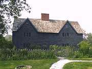
The John Kimball House and the House with Orange Shutters.
These houses were both owned by the Kimball family. The John Kimball house resembles the
House with the
Orange Shutters next door. This house, however, has an unusual 12 inch overhang and an
early molded gutter.
The interior represents 2 different periods. The great keeping room to the left has a
chamfered summer beam with a
small cupboard with wide-board tongue and groove sheathing, all in a rich, old tobacco
brown color. The rooms on
the right side of the house are Federal in appearance with painted woodwork, smaller
fireplaces, wall-papered walls,
and fine 18th century panelling.


The House with Orange Shutters
is of similar first period framing and construction. There is a large fireplace in the
"keeping" room on the left. An
earlier resident in the 20th century introduced the orange shutters and the front fencing
which have become easy
ways to identify the house.
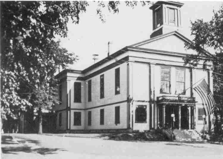
Town Hall
Old Burying Ground. (1634) High Street.

The first people known to be buried in the cemetery were the wife and child of John
Winthrop, Jr., who led the
settlement of the town. There were no cemetery markers at that time, so the exact location
of their graves is
unknown. There are gravestones that date back to the 1600's. Nathaniel Rogers is buried
near the path, his stone
depicting his wearing a jacket with 14 buttons. Thomas Berry is buried near the cluster of
Rogers stones, as his first
wife was a Rogers. A contemporary black stone is visible from the sidewalk that marks the
common grave of the
people who died when the Falconer was wrecked in a terrible storm off Cranes Beach. On one
of the terraces, is
the grave of Emma Safford, who was one of the last direct descendants of Masconomet.
Photos from Harold Bowen's files.
![]()
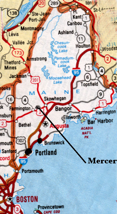
Mercer, Somerset County, Maine
birth place of Hartley Kimball and descendants.
The earliest known owners of the land which is within the present limits of the town of
Mercer most certainly must have been the Indians who had a settlement at Old Point in
Madison as they roamed up and down the Kennebec and Sandy River. ( the correct name
of the Sandy is Penobsquisunquis - sebu. )
The Indians had quite a different interpretation of land ownership than did the white man.
Some writers have indicated that the Indians believed that when a member of the tribe
died the land which he was using reverted back to the tribe and was given to another
member of the tribe to be used during his lifetime. The white man on the other hand
believed that, once obtained, ownership of the land was his to do whatever he wanted to
do with it.
The King of England considered that he had the sole authority to make grants of land in
this country without consulting anyone. On November 3, 1860 King James 1 granted the
Plymouth Company a large tract of land north of a former grant made to the famous
Virginia Company. The Plymouth Company was made up of Sir Ferdinando Gorges and
thirty-nine of his friends. The King's grant was;
"...... for all the country called New England in America, situated lying and being
in
Breadth from forty Degrees of Northerly Latitude from the Equinoctial Line, to forty-eight
Degrees of said Northerly Latitude inclusively, and in length and in all Breadth aforesaid
throughout the Main Lands......"
The grant included all of the natural resources which might be found on the land, and the
settlers were required to pay the King one fifth of all gold and silver which they found
in
their grant of land.
In 1622 the Plymouth Council granted part of their original grant to Sir Ferdinando Gorges
and Captain John Mason. This grant was called the Laconia Patent. Gorges' share of the
grant included the land which became Mercer in 1804. Unlike Mason, Gorges did not obtain
a separate patent to his land, which he called Somersetshire, until 1635. In the meantime
the Plymouth Council had granted William Bradford and his associated a tract of land near
the Kenebec on January 16, 1629 which included a part of the Gorges' grant. Bradford's
grant took the land along the Kenebec for fifteen English miles on either side of the
river.
In 1639 King Charles I issued a new charter to Gorges which confirmed the Plymouth
Council's grant to Gorges of the Province of Maine in 1635. By this charter Gorges
received
all the land between the Piscataqua and Kenebec Rivers north of the Dead River area.
The Massachusetts Bay Colony found in its charter what they considered a reasonable
excuse for extending their jurisdiction over the south-western portions of the Province of
Maine, which they did in 1652.
William Bradford and his associates assigned the tract of land along the Kenebec to the
Colony at Plymouth. The New Plymouth Colony conveyed this tract of land
"......on the Twenty-seventh Day of October, AD 1661, being seized of the whole tract
aforesaid on Kenebec River, and also all lands on both sides of the said River, upwards to
Wiserunscut alias Wessercunskick, by their Deed of Bargain and Sale of that Date, for and
in consideration of the Sum of Four Hundred Pounds Sterling, Sold all the Land of Said
River to Antipas Boyes, Edward Tyng, Thomas Brattle, and John Winslow, their and every
of their Heirs and Assigns forever, as by the Deed registered in the records of the said
Colony may more or fully appear, And the Lands last mentioned to the said John Winslow
and his Partners aforesaid, theirs heirs and Assigns forever, on both sides of said
Kenebec
River as far as the upper or most Northern Part of Wesserunskick aforesaid. "
Seventeen years after the above transaction took place, Ferdinando Gorges Esq., grandson
of Sir Ferdinando Gorges, sold the land which he had inherited from his grandfather. On
March 13, 1678, " John Usher, of Boston in New England in America, merchant, "
bought all
the lands comprising the Province of Maine for 1250 Sterling Pounds. John Usher in turn
sold this land two days later to the Massachusetts Bay Colony.
After William and Mary came to the throne of England in 1688, a new charter was issued
which united the colonies of Plymouth, Massachusetts, the Province of Maine, and all the
lands as far east as the St. Croix River into one colony. This events occurred in the year
1692.
Let us return now to the grant of land from the New Plymouth Company to the partnership
of Antis Boyes, Edward Tyng, Thomas Brattle, and John Winslow. From 1661, the date of
the grant, until 1749 very little had been done by these grantees or their heirs in
encouraging settlement of the grant. The presence of the Indians probably had much to
do with this lack of activity in the interior part of the grant. In 1749 they began to
think of
settling their lands.
" In September of that year, a meeting of the proprietors was called, and new members
were admitted. Four years later, Massachusetts passed an Act permitting persons holding
lands in common and undivided, to act as a corporation. In June 1753, under this act, a
corporation was formed by the name of ' the Proprietors of the Kenebec Purchase, from
the late colony of New Plymouth ' which continued to be their legal title, though they are
commonly known by the name of the Plymouth Company, and their lands as the Plymouth
Patent. "
The Proprietors of the Kenebec Purchase continued to hold regular meetings until 1816. At
this time they completed the business of disposing of their property.
The Proprietors of the Kenebec Purchase did not for some reason have their lands
surveyed into lots, which caused them problems after the Revolutionary War. At this time
many soldiers and their families began to move into the Patent. These soldiers for the
most parts had been released from the service without having received pay for the service
rendered their country. They were poor and desired a new place to make permanent
homes and to begin farming. It is apparent from what followed that they did not inquire
as to the ownership of the land where they settled. By 1799 the Proprietors of the
Kenebec Purchase discovered that there were many settlers along the Sandy River on land
which had not conveyed to the settlers by the company. The settlers refused to allow the
company to come in and survey their lots unless they first knew what the land was going
to cost them. The company tried several times to get a survey of the lots by using
different tactics but each one failed. As a final resort, the Proprietors took their case
to
the legislature of the Commonwealth of Massachusetts. On February 19, 1802 the
Massachusetts Legislature approved a
" Resolution on the Petition of Aroda Thayer in Behalf of the Proprietors of the
Kenebec
Purchase, Authorising the Company to Quiet the Settlers on Said Lands, and Empowering
the Governor with Advice of the Council to Appoint Commissioners to Adjust and Settle all
Disputes Between Said Proprietors and Settlers on Said Lands. "
On October 15, 1802, Lemuel Perham signed his surveys and presented them to the three
appointed commissioners who were meeting at Thomas's Tavern in Augusta. The
commissioners notified all parties that they would be in session at Thomas's Tavern to
hear their claims. These commissioners did not visit the settlers' lots to inspect the
improvements which had been made upon them. This would appear to be a distinct
disadvantage to the settlers when their cases were brought before the commissioners.
Each settler was given a deed to the property which he had settled on in the Kenebec
Purchase. These deeds were not issued until the settlers had paid for the land as well as
the interest on the note, and had paid two dollars for each deed. As one example Luther
Burr had to pay ninety dollars for lot 31 which consisted of one hundred acres. This lot
was partly in Industry Plantation and partly in Starkes. Interest was charged from the
first
of April, 1803
until June 1, 1804 when Burr had to have the lot paid for, according to the decision
handed down by the commissioners.
Nicholas Kimball purchased lot number 28 on Lemuel Perham's Plan No. 5 dated 15th
October 1802. This was three lots north of Burr's lot and then, inside the Starkes line.
Nicholas' lot was adjoined by Joseph Smith on the south and Joseph Williamson on the
north.
Location.
Mercer is located between 440 35'30" and 440 43' north latitude and is between 690
51' and 690 58' west longitude.
It lies at the extreme southwestern corner of Somerset County where three towns and three
counties all come
together atop Hampshire Hill. Somerset, Franklin and Kenebec counties along with Mercer,
Rome and New
Sharon share this point. Mercer has five sister towns for neighbors Norridgewock and
Smiyhfield on the east, Rome
to the south, New Sharon and Starks on the west, and Starks and Norridgewock on the north.
The countryside is
gently undulating with sandy alluvial deposit which was probably left by many freshets
along the river. In the back
country, the soil is a clay-loam mixed with granite rocks. Some gravel deposits can be
found in various sections of the
town. On Beach Hill iron pyrite was found in small quantities along with some quarts
crystals. Ashbury Greenleaf
panned for gold in the Sandy River near Dickinson's Rips years ago with some success but
not enough to make a
living of iMost of the trees and other plant life which grow in the northern part of the
United States can be found in
Mercer. The white pine, hemlock, fir, and cedar are the most common coniferous trees. The
birch, beech, ash, oak,
maple and elm are the most conspicuous deciduous trees which are predominant in all
sections of Mercer. The
streets of Mercer are lined with sugar maple and the majestic elm which provides shade,
although the Dutch Elm
Disease has claimed many of the largest elms in the village.
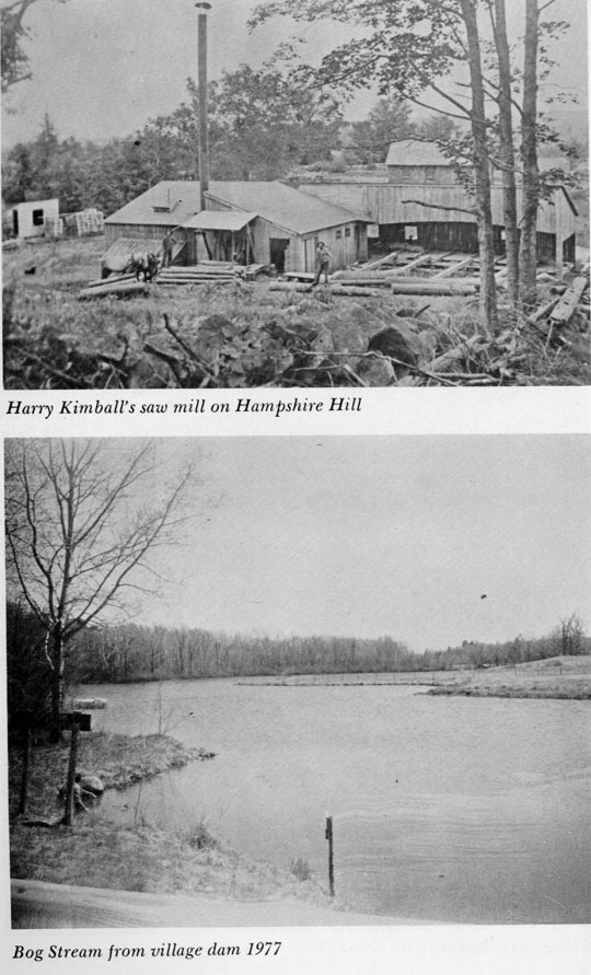
Mercer can claim one of the largest elm trees ever grown in New England which stood on the
banks of Bog Stream.
It was thirty-two feet in circumference in 1860 before it fell victim of lightning which
struck it on two occasions. The
aptly named Elm Street where the Kimballs lived was also known as " chicken run
" because of the vast number of
fowl running free in the streets and about the homes.
Mercer has its moose, bear, bobcats, skunks, rabbits, groundhogs, raccoons, deer and many
other animals of the
northeast. Of all the animals mentioned, the deer is the most sought after game animal in
Mercer. From 1939 until
1953 the hunters in Mercer bagged an average of 40 deer a year. During the next fifteen
years, from 1954 to 1969,
the average legal kill has been 57.6 a year. Partridge and woodcock are two game birds
which can be seen in the
uplands and it is possible to hunt duck during the open season on North Pond and Bog
Stream.
The Sandy River was formerly a salmon river and a favorite spawning grounds. Shad and
Alewives also used the
river and were commonly used for food by the early pioneers in the Sandy River settlement.
Trout can be caught in
Indian Stream, upper Bog Stream, and Brick Yard Brook while bass can be caught in Sandy
River and North Pond
along with pickerel and white perch.
The climate of Mercer is one of cold winters and warm summers. The rains usually arrive in
the spring and late fall
months with a few showers or rainy days in summer. Snow appears in late October or early
November and usually
remains until April. The average precipitation for Mercer and the rest of Maine is
forty-five inches a year. The
temperatures may vary from a minus thirty to a plus 100 degrees but these extremes are not
the common thing.
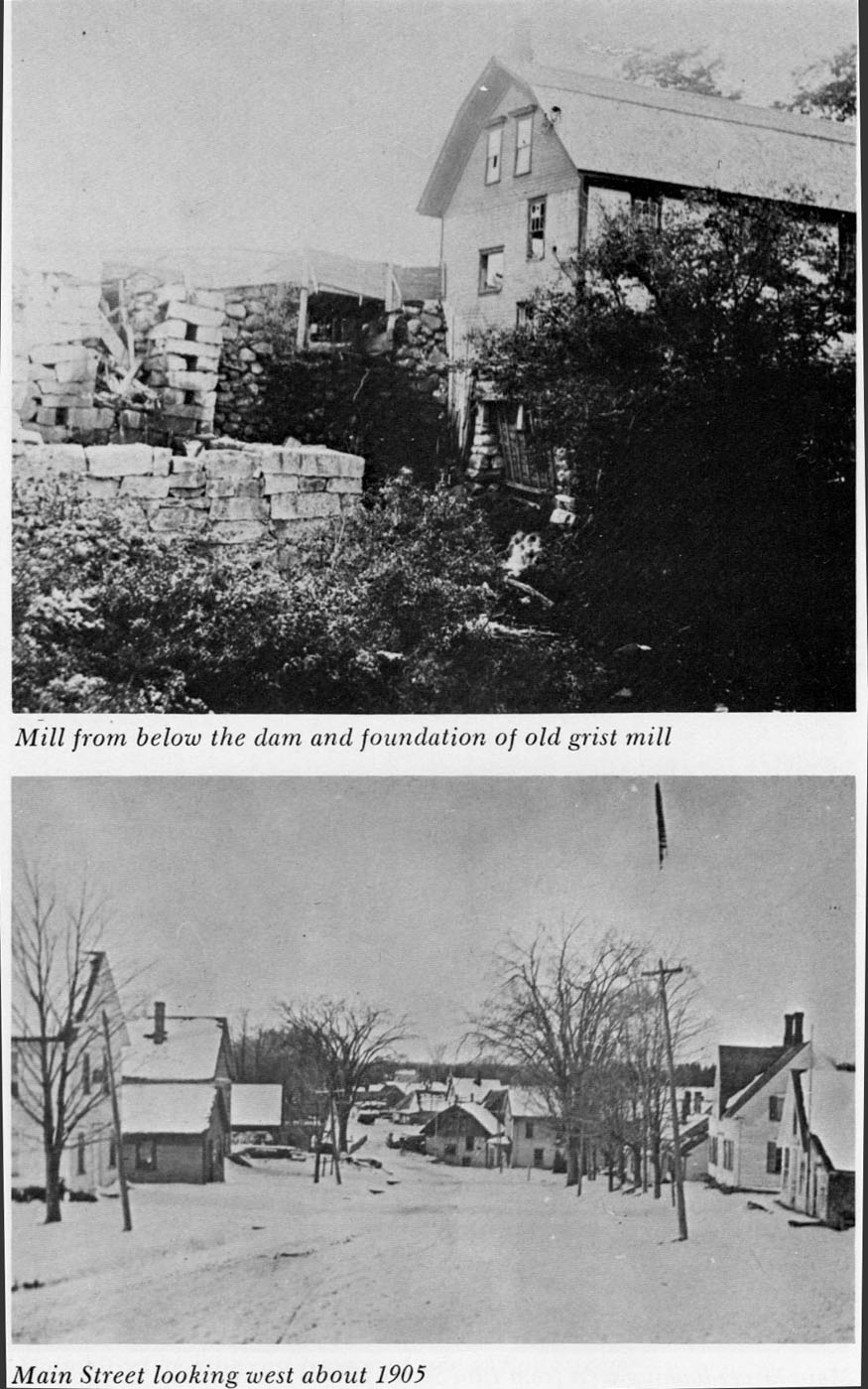
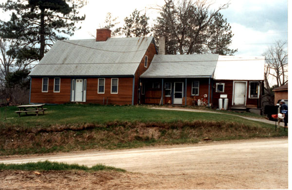
The Kimball Home built 1798 in Elm Street, Mercer. Now occupied by the True family.
Beechworth, Victoria, Australia
![]()
marriage place of Cyrus Kimball & Grace Owens.
about 40 Klms south east of Albury - Wodonga at the head of the Ovens River
Gold was discovered at Beechworth ( or Chewton ) in 1852. By the late 1850s the settlement
had grown to over
40,000 with, among other enterprises, four breweries and 61 hotels and became the
administrative centre for north
eastern Victoria. Ned Kelly made three appearances in the court house and was confined in
a cell beneath the town
hall and his mother and members of his gang also appeared in the court building ( in the
late 1860s and 1870s some
time after Cyrus Kimball had moved to Ironbarks NSW. )
A historic former gold-mining town in the foothills of the Alps, and renowned for it's
autumn beauty and the
Victorian character reflected in the elegant lines of its honey coloured granite
buildings. At least 30 of its buildings
have been restored and are classified by the National Trust. The powder magazine, built in
1859, has a cunningly
built circular roof designed to confine explosion. The 1867 Bank of Victoria building
retains the original gold vault,
while the London Tavern still has a bath house standing in the courtyard. The Classical
facade is all that remains of
the hospital. Several thousand Chinese were among the diggers and they had their own
cemetery and traditional
burning towers.
Two monuments recall the gold era. One shows a miner's pick and pan. The other has gilt
horse shoes atop a cairn
in memory of the day miners paraded their first Member of Parliament, Donald Cameron, on a
horse shod with
gold.
Rutherglen,
Victoria
birth place of Hartley Owens Kimball
about 45 Klms west of Albury - Wodonga on the Murray River.
Settlers arrived in the 1830s seeking pastures for sheep and cattle. Gold found in the
1850s brought a huge influx of prospectors and the usual hangers-on; later, additional
gold was recovered by cyaniding old dumps.
Vines came at the same time as the gold discovery and at one stage mining and grapes
supported a population of 25,000. At the turn of the century a plant mite, Phylloxera,
virtually destroyed the wine industry and only a quarter of the original area was
replanted.
The Seppelt winery is easily recognisable because of the palm trees traditional to the
company's establishments. A cellar in the main street has a licence restricting it to
selling
only wines from the district. The Victoria Hotel has stood since 1868. To the south east
is
Murdering Hut Creek. At a shack at Ullina station in October 1850, Matthew Madden, a
stockman, killed his drinking mate with a shearing blade after their all-night session on
rum.
Rutherglen, in Scotland, was the original home of John Wallace, a well-known gold field
personality.
Ironbarks, NSW ; ![]()
birth place of Ward Brown Kimball & Eliza Jane Kimball.
Now known as Stuart Town is situated about 55 Klms From Orange and 30 Klms from
Wellington.
It has a population of about three hundred, two general stores and a Hotel.
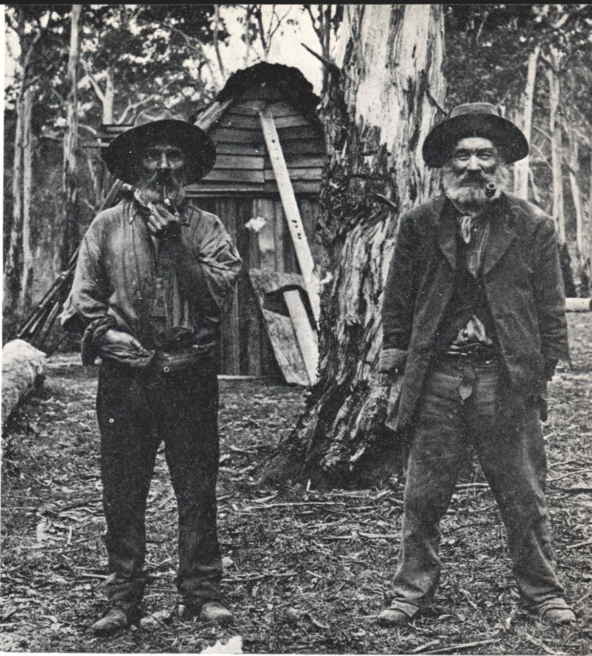
A pair of typical farm hands
Who would have
believed that little more than a hundred years ago, this town was
swollen with thousands of people all trying to make their fortune by finding that elusive
yellow mineral, gold. A few years before Edward Hargreaves discovered gold near Orange
in 1851, a slow thinking shepherd named Wallace often picked up small yellow slugs that
caught his eye as he was walking or riding around the rugged country about a mile from
Ironbarks. It was some time after Hargreaves' discovery became known that Wallace
showed several of these slugs to his friends who had long debates as to what they were.
As none of them had ever seen native gold, it wasn't until the slugs were show to a coach
driver named Hogan, that they were correctly identified as gold, and then the rush was on.
The news spread like wildfire, and a hoard of would-be-miners invaded the region which
they named Ironbarks, after the trees in the area.
Some of the more famous mines in the area were the Post Office, Princess, Canadian,
Perseverance, Princess Alexandra, Specimen Hill, Madman's Mine and probably the most
famous, the Prince William or just plain Billy Mine at Farnham.
From Ironbarks to Oakey
Through Pine Park to the Gap,
From Burrendong to Hawkins Hill
Then back to Sally's Flat,
Quartz leaders hide within the hills
Gold nugget 'neath the flats
Tho' only gibbers greet the eye
Along the beaten track.
N.A. Samuel
From Ironbarks to the Darling
Towards the setting sun;
With bullock dray and horse,
They moved out one by one.
They blazed a track across the plain,
They toiled from morn to dark;
They drove out sheep and planted grain
Built homes of mud and bark.
When wattles bloom upon the hills,
When pastures green look best;
We humbly think of those that proved
Life worthwhile - far out west.
N.A. Samuels

Grenfell
, NSW;
birth place of Harriet Grace Kimball
about 20 Klms west of Cowra
In the central west of New South Wales where the western slopes from the
Great Dividing Range begin to merge into the western plains, on a line due
west of Sydney from which it is 276 miles by rail, is the town of Grenfell
standing 1238 feet above sea level, centre of the Weddin Shire which
stretches out as a vast wheat field - a golden granary - for twenty five miles or
more farther westward to the Forbes to Stockbingal railway line and beyond.
Time was, before the miners came and went, when Grenfell was a sheepwalk
and its district a squatters' paradise. The early colony which had been
confined for a quarter of a century to the area around the centre of its
establishment - Sydney Cove - expanded rapidly after the Blue Mountains to
the west had been crossed by Blaxland, Wentworth and Lawson in 1813 and
the western plains had been examined by surveyor George W. Evans who
discovered the Macquarie River on which Bathurst was laid out by Governor
Macquarie himself in 1815.
The year 1866 is outstanding in the annals of Grenfell for it was in that year
that Grenfell grew from an unnamed sheep run to a thriving populous village
during a few short weeks and within a year was a busy town complete with
houses, stores, hotels, hospital, school and churches. As early as December
29, 1863 a correspondent in the Sydney Morning Herald stated of Bogolong, " I
may mention here that this ridge has every appearance of being auriferous, the whole
character
of the region being precisely of gold-bearing country. "
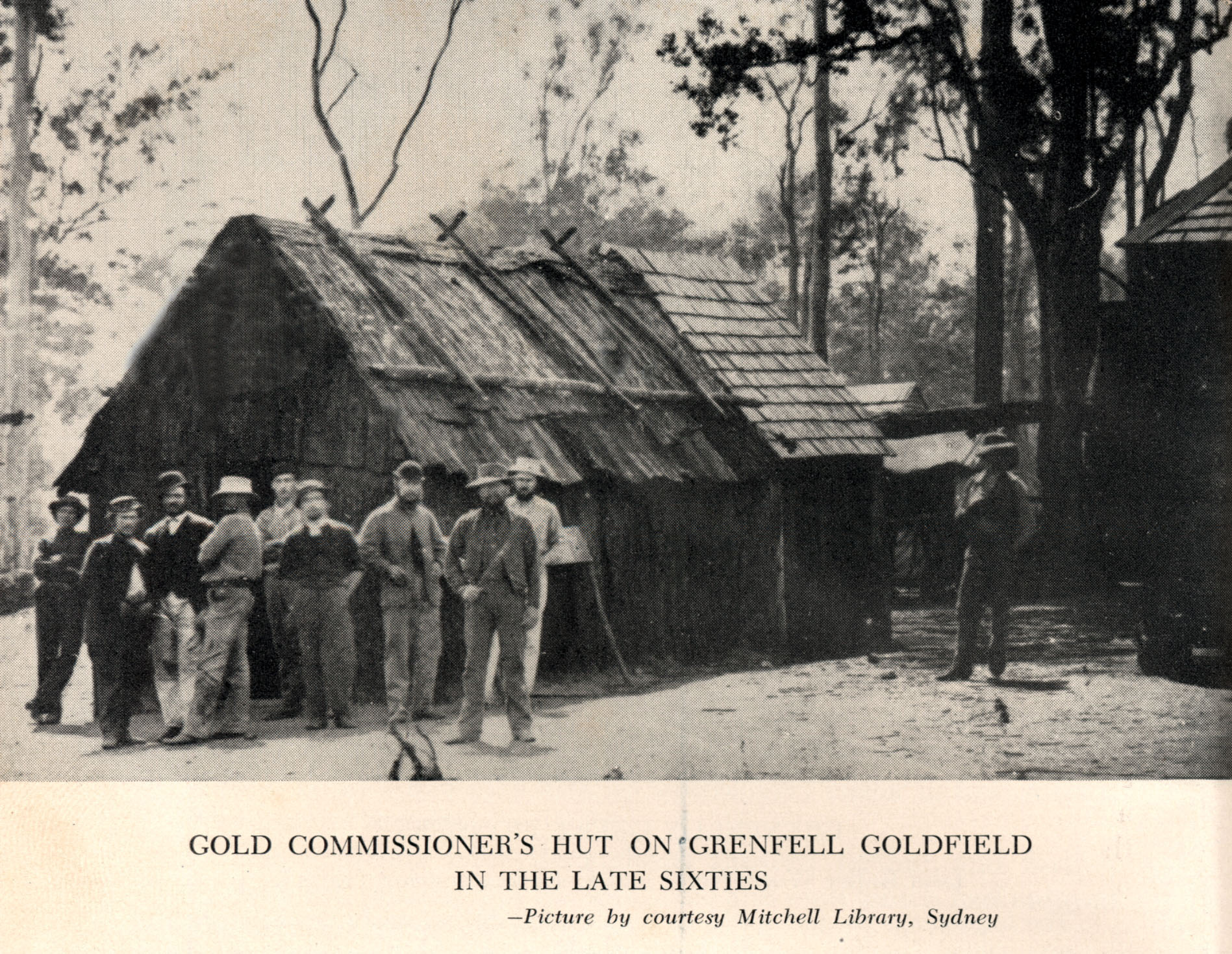
By January 1867 it was estimated that 10,000 men were on the field where on
all sides were to be seen the yellow mounds of mullock thrown up by the
miners and the first crushing machine brought from the Billabong Reefs on
the Forbes gold -field was operating. The town grew around the main lead
which in places was sixty feet wide and ten feet deep. Every gully around
Emu Creek was tried by the miners who began to search for alluvial gold
shortly after the working reefs had begun. The first lead became a mile of
golden holes by December 1866. In 1868 Grenfell was the largest reefing
district in the colony.
A township sprang up at the Seven Mile or Weddin but dwindled again in a
few years after the gold gave out. A small farming community took its place.
Reefs in the vicinity were Homeward Bound, Lucknow, Enterprise,
Frenchman's, Welcome and Outward Bound. they ranged in depth from 100
feet to 400 feet. At the height of the rush thirteen batteries operated on the
field to crush the ore and all prospered for two years. Around the whole of
the leads the miners threw up hillocks of mullock, many of which were
levelled with the growth of Grenfell but a vast number of which remain
around the town and district as does the heap of cyanided sand above the old
One Mile claim near Lawson Park today.
By 1870 ( about the time Cyrus and his family arrived in the area ) the
Grenfell goldfields had become quieter, the Town and Country Journal of
May 14 reporting that, although the town had a considerable population and
trade, it was not quite what it was in the palmy days of the Emu Creek
goldfield.
The decline of the goldfields population continued until in 1973 the
population of the district was given at 3000, with 1250 in the town itself. Two
years later the gold era was creeping to a close its close. The original
discoverer of gold, Cornelius O'Brien, left the district in July 1875.
Between December 1866 and March 1874 records showed that 214,969
ounces were despatched, their value being 1,000,000 pounds , whilst in all
official records show that 12.5 tons of gold valued at 1,705,550 pounds were
won.
In 1879 Dr. Carr who was well known in Grenfell in its palmy days painted a
vivid picture in the Grenfell Record of March 22 of the goldfields life as it was in
the colourful gold rush days. " Before, " wrote Dr. Carr, " the hundreds of
miners
flocked down, dressed in the traditional costume of miners in pants, shirts and shoes,
slouched
hats, sashes red and green to embellish the trouser waists, collars down over bare bronzed
throat, sleeves rolled up and pipes stuck 'twixt their teeth. They massed down from such
claims
as Lucknow, Homeward Bound, O'Briens, Prussian, Welcome and many others. These are
now idle ... Now in the evening, the streets are silent and the few who pass by do so like
sentinels on some lonely fort."
The gold rush days were over; their glory was departed ; but they left a
prosperous town with its surrounding villages to serve again as a flourishing
business centre - a centre for gold of another kind - the golden grain and the
golden fleece.
This sleepy farming town grew out of a roisterous gold camp, and among the
prospectors was Peter Larsen. A monument stands where he pitched the
family tent and his wife Louisa , in 1867 ( three years before Harriet Grace
was born ) gave birth to their son, poet and writer Henry Lawson. Remains of
diggings can still be found along Emu Creek.
The curving main street is faced by several attractive 19th century buildings,
including verandahed hotels decorated with intricate ironwork. In the gold
days there were 30 pubs. The Presbyterian Church was built in 1868 by a
minister who had served his apprenticeship as a stonemason, while St
Joseph's Catholic Church is enhanced by three altars of Italian marble and a
bell from Ireland. Ben Hall farmed at Wheogo, to the north west, before
taking up bushranging.
The Welcome , NSW;
![]()
first permanent home of the Kimballs in Australia
The Welcome was located in the proximity of present day Parksbourgh, just south of Parkes.
By 1872 approximately 6000 men were working the gold fields surrounding the 'Bushmans (
later to be named
Parkes). Although many rushes occurred in the surrounding districts almost all disappeared
as the gold ran out and
the diggers moved on. The Welcome was one of these towns although the site where it stood
is still sign posted and
the old general store and post office still stands on the site of Cyrus' original store
and what is believed to be possibly
the first home built by Cyrus Kimball is still occupied by his descendant Colin Woodward
and his son Michael. (
1998 )
The main Welcome Lead was discovered in 1872 to the south of Bushmans. The Welcome group
contained
Tearaway, Frenchman's', Paddy's Flat, Little Welcome, Melbourne and Fulton Leads. The
Tearaway was found in
1873 and the New Welcome in December 1875.
The leads of the Welcome were shallow, the main channel having a maximum depth of about
140 feet. In 1891 a
prospecting vote was granted to search for the south-east extension of the Welcome and
other leads which
terminated close to the northern bank of the creek. Fourteen shafts were sunk in this
campaign to 154 feet but
without success.
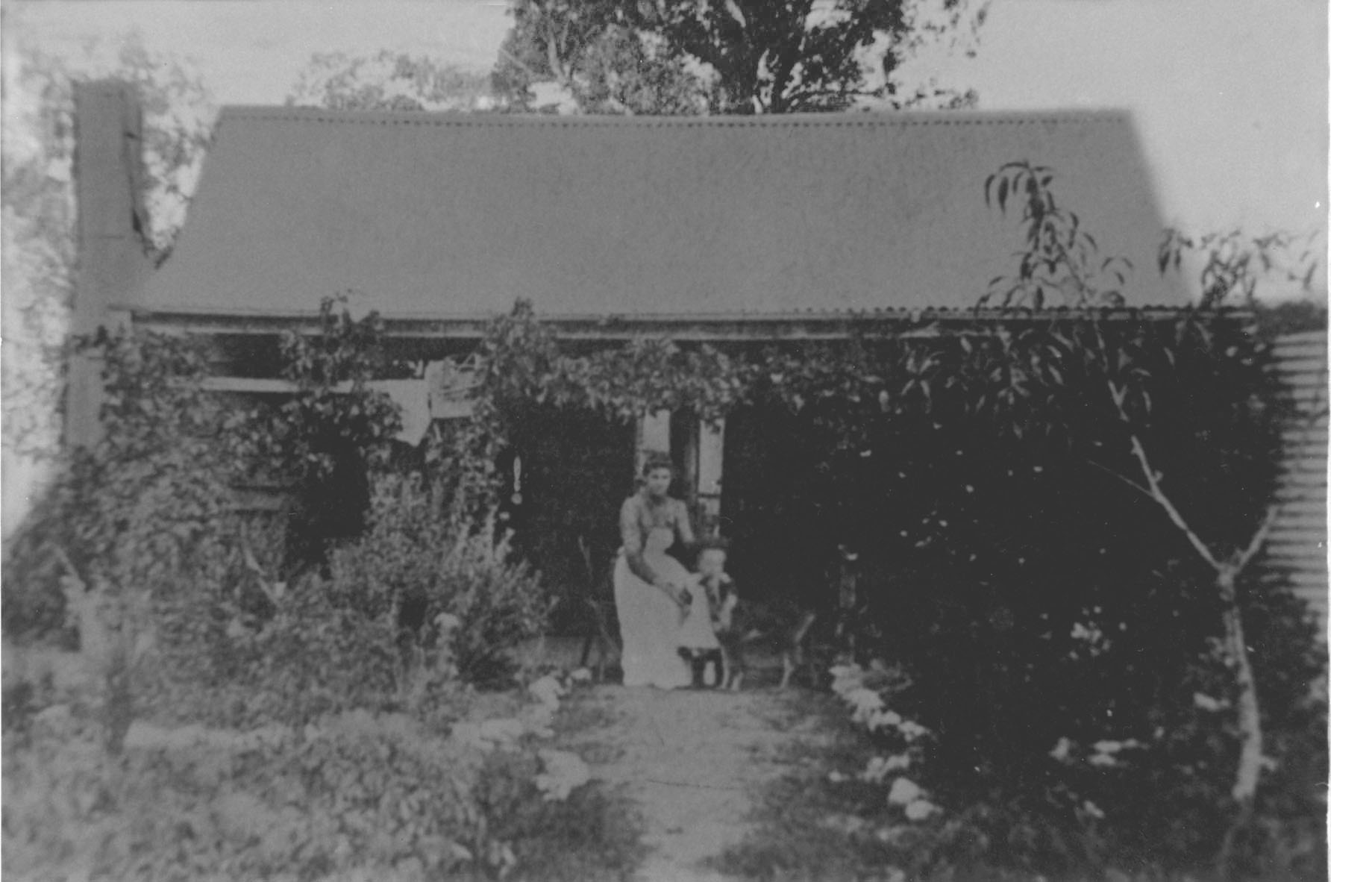
The first permanent home built by Cyrus Kimball in Australia at " The Welcome "
near Parkes, NSW ( Harriet with
young Benjamin Bryant )
Links to more Photos
![]()
